Val di Fiemme (Cavalese-Predazzo-Passo Rolle-Lagorai-Passo Manghen-Pampeago). The map covers the whole territory of the Val di Fiemme Community going from Stramentizzo Lake (Monte Corno Natural Park) on west side till Passo Rolle (Paneveggio Natural Park). It includes the central-east side of the Lagorai mountain range, extending south towards Passo Manghen and Cima d’Asta. In the northern side the Latemar dolomitic range and the Pampeago Alp are included.
Lagorai Cima d’Asta (Translagorai - Ski alpine - MTB trails - The eastern Trentino Horse Trail). The map covers the entire area of the Lagorai mountain range and extends from the town of Pergine Valsugana in the west to Passo Rolle in the east in the heart of the Paneveggio - Pale di San Martino Natural Park. To the south it partially includes the territory of the Valsugana, while to the north it includes a large part of the Val di Fiemme.
Val di Fassa (Sellaronda MTB Track Tour, Mountain Bike Official Trails, sci alpinismo - skitouren). To keep this map up-to-date, 4LAND has been constantly collaborating for years with the main experts in the mountains of the Val di Fassa, with the Alpine Guides, with the MTB Guides, with the Alpine Rescue. Also noteworthy is the contribution of the APT Val di Fassa, which every year collects all the contributions of the valley in terms of changes to the paths, facilities, points of interest.
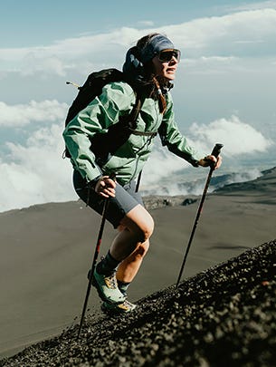
Cortina (Includes MTB, ski mountaineering and snowshoeing tours). The Ampezzo basin, famous all over the world, needs no introduction. The undisputed beauty of the Dolomite crags spills over the vast valley of Cortina, influenced by meadows and woods which, like a link, bring the whole to perfect balance.